15-Minutes City
Delinealing a '15-Minute City' - An Agent-based Modeling approach to estimate the size of local communities.
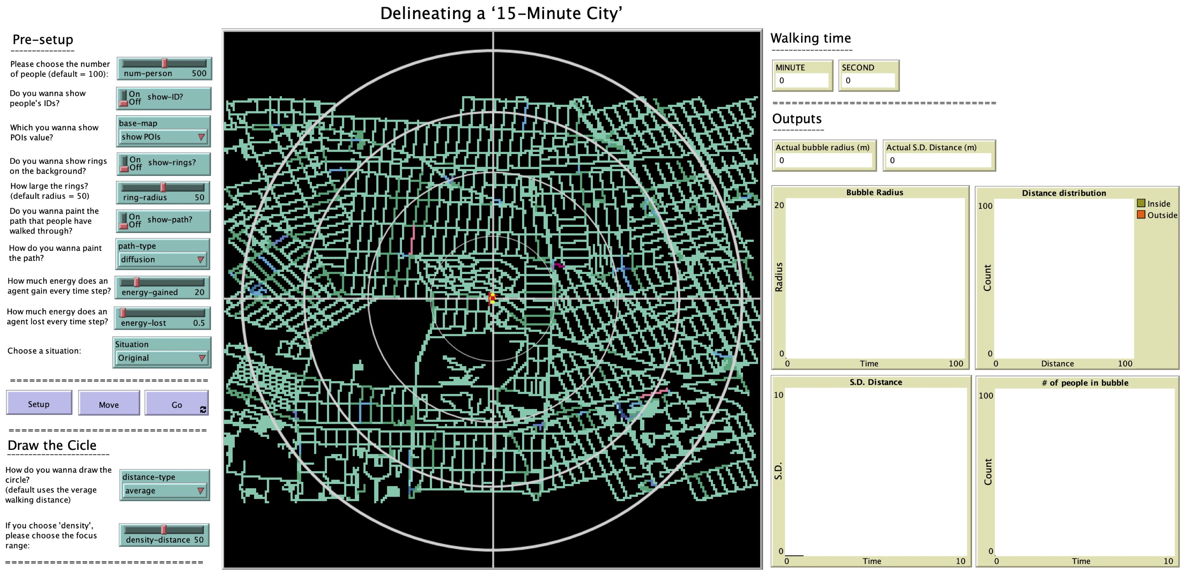
With progressively increased people living in cities, and lately the global COVID-19 outbreak, human mobility within cities has changed. Coinciding with this change, is the recent uptake of the ‘15-Minute City’ idea in urban planning around the world. One of the hallmarks of this idea is to create a high quality of life within a city via an acceptable travel distance (i.e., 15 minutes). However, a definitive benchmark for defining a ‘15- Minute City’ has yet to be agreed upon due to the heterogeneous character of urban morphologies worldwide. To shed light on this issue, we develop an agent-based model named ‘D-FMCities’ utilizing realistic street networks and points-of-interest, in this instance the borough of Queens in New York City as a test case. Through our modeling we grow diverse communities from the bottom up and estimate the size of such local communities to delineate 15-minute cities. Our findings suggest that the model could be helpful to detect the flexibility of defining the extent of a ‘15-minute city’ and consequently support uncovering the underlying factors that may affect its various definitions and diverse sizes throughout the world. Figure 1 dispalys an overview of the designed model interface.

Model design
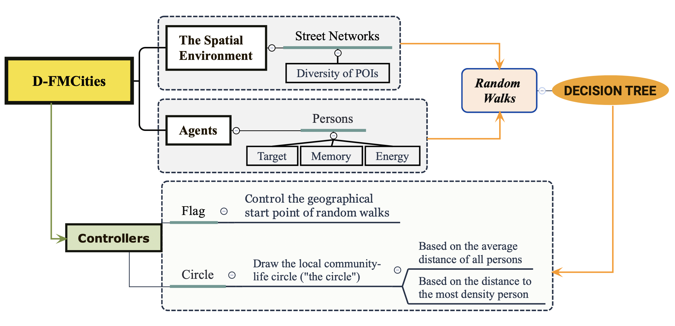
Figure 2 gives an overview of the model structure. At model initialization, the controller - Flag - is placed at the geographical center of the study area. It is necessary to point out that although the default start point is set at the geographical center of the existing environment, however, it could be adjusted to any other place within the environment, such as community centers, schools, and so on, depending on the specific research focus. Once the start point is determined, the agents (i.e., persons) are then placed at that point. When the simulation begins, the agents start randomly walking along the streets.

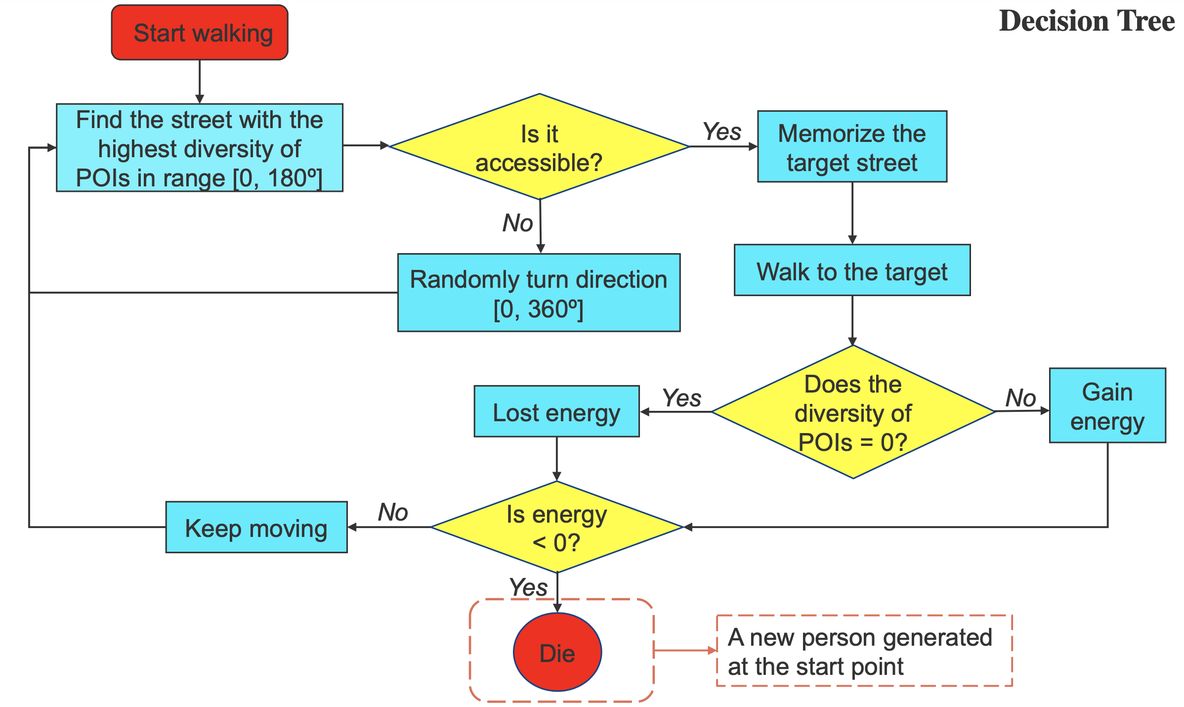
At each time step (i.e., 10s), each agent needs to determine where to go according to a decision tree designed in the model as shown in Figure 3. Generally speaking, an agent chooses to walk on streets with a high diversity of POIs (i.e., the target) in front of itself and walk to the target and stores the street to its memory; otherwise, the agent chooses a random direction and repeats the previous step until it finds a target that satisfies its wanting for high diversity. Every time the agent moves, it either gains or loses a certain amount of energy, depending on the diversity of the POIs of the street visited. If a visited street has no POIs, the agent loses a certain amount of energy. This is based on the assumption that a street with a low diversity of POIs may be less attractive to people. Conversely, if a visited street has a large number of POIs, the agent gains a certain amount of energy, where the amount varies with the diversity indicator. So, the higher the diversity is, the more energy the agent gains. The hypothesis here is that a street with a high diversity of POIs is more likely to arouse people’s enthusiasm for walking as they can do more things there (e.g., shopping, recreation).

Once an agent runs out of its energy, it dies (i.e., is removed from the environment), which indicates the agent has gotten bored or tired and intends to go back home. In such cases, a new agent is created and placed at the same start point and the model continues to run. It is important to note that the energy value itself is user-settable within the model. The larger the energy value, the longer an agent walks on the street or vice versa.
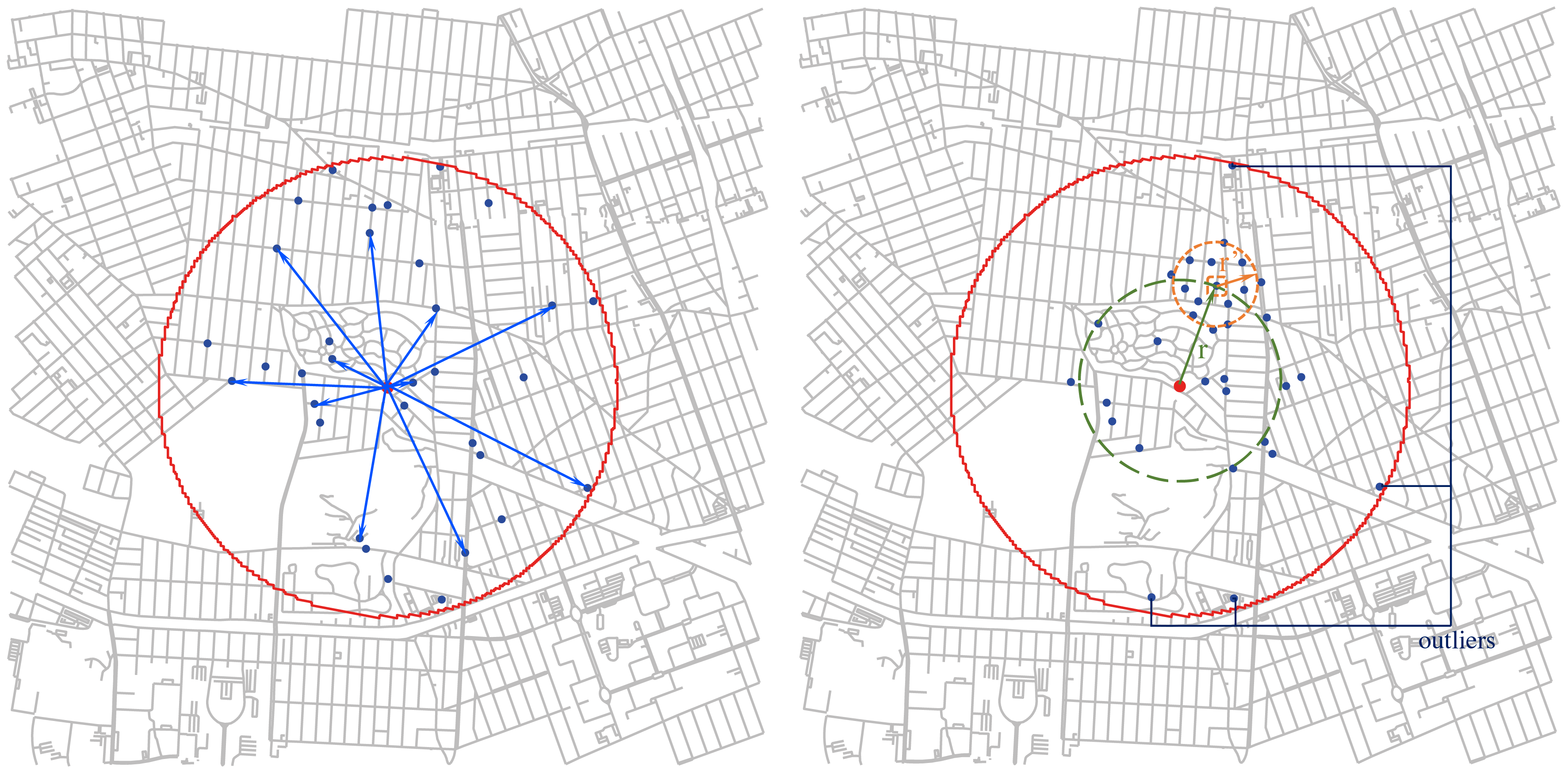
Simultaneously, the model computes the real-time walking distance as the radius of the local community circle. There are two embedded methods to measure the walking distance. The first approach estimates the walking distance as the average distance of all people on the streets (see Figure 4(left)). However, this approach may potentially inflate walking distances due to some agents walking more than others (i.e., outliers) (see Figure 4(right)). As such, we implement another method to circumvent the potential impact. Specifically, the second method calculates the real-time radius based on the distance between the start point and the agent within the model with the highest population density around itself (which is set to 50m in this paper, but it could be changed if desired in future research) (see Figure 4(right)). The computed result is subsequently transferred to the controller - Circle - for drawing the local community circle.

The model itself is written in Netlogo and to make the model comparable, reproducible and expand upon what we have written here, all code and data are publicly available. The D-FMCities model itself can be found at: delineating-a-15minsCity while a demo of it is available at: model-demo. For more details, please check out out paper below.
Chen, Q. and Crooks A. (2021) Delineating a ‘15-minute city’: an agent-based modeling approach to estimate the size of local communities. GeoSim ‘21: Proceedings of the 4th ACM SIGSPATIAL International Workshop on GeoSpatial Simulation, November 2021, Pages 29–37, https://doi.org/10.1145/3486184.3491080